- Title
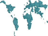
- Transboundary River Basins
- Abstract
Transboundary Freshwater Dispute Database, Department of Geosciences, Oregon State University (http://www.transboundarywaters.orst.edu), Watersheds of the World published by the World Resources Institute (http://www.wri.org/publication/watersheds-of-the-world)
- Publication Date
- Nov. 25, 2017, 6:25 p.m.
- Type
- Vector Data
- Category
- River Basins
- A river basin is an area of land drained by a river and its tributaries.
- Published
- Yes
- Featured
- No
- Name
- gridanode
- devrsgis@gmail.com
- Position
- Organization
- GRID-Arendal
- Location
- Voice
- Fax
- Identification Image
-
- Spatial Resolution
- ---
- Projetion System
- EPSG:4326
- Extension x0
- -164.4714006210
- Extension x1
- 145.0291666670
- Extension y0
- -54.7499854200
- Extension y1
- 71.6381050930
- Language
- English
- Supplemental Information
No information provided
- Name
- gridanode
- devrsgis@gmail.com
- Position
- Organization
- GRID-Arendal
- Location
- Voice
- Fax
- Link Online
- /layers/geonode:transboundary_river_basins
- Metadata Page
- /layers/geonode:transboundary_river_basins/metadata_detail
- Tiles
- Transboundary River Basins.tiles
- Legend
- Transboundary River Basins.png
- Thumbnail
- Transboundary River Basins.png
- Remote Thumbnail
- Transboundary River Basins.png
- View in Google Earth
- Transboundary River Basins.kml
- KML
- Transboundary River Basins.kml
- GeoJSON
- Transboundary River Basins.json
- Excel
- Transboundary River Basins.excel
- CSV
- Transboundary River Basins.csv
- GML 3.1.1
- Transboundary River Basins.gml
- GML 2.0
- Transboundary River Basins.gml
- Zipped Shapefile
- Transboundary River Basins.zip
- PNG
- Transboundary River Basins.png
- Transboundary River Basins.pdf
- JPEG
- Transboundary River Basins.jpg
- OGC WFS: geonode Service
- Geoservice OGC:WFS
- OGC WMS: geonode Service
- Geoservice OGC:WMS
- Name
- gridanode
- devrsgis@gmail.com
- Position
- Organization
- GRID-Arendal
- Location
- Voice
- Fax