- Title
- Seamount geomorphic feature layer
- Abstract
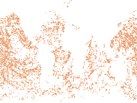
The seamount geomorphic feature layer represents the spatial extent of the seamounts of the worlds oceans based on interpretation of the SRTM30 plus v7 global bathymetry model. The layer is one of the 25 layers that make up the global seafloor geomorphic features map (Harris et.al. 2014). Seamounts are “a discrete (or group of) large isolated elevation(s), greater than 1,000 m in relief above the sea floor, characteristically of conical form” (IHO, 2008). Seamounts are thus defined as peaks that rise over 1,000 m above the seafloor, calculated based on the SRTM30_PLUS model. We adhered strictly to the requirement that seamounts are “of conical form”, thus distinguishing “seamounts” (having a length/with ratio <2) from ridges (having a length/width ratio ≥2). The criterion of a length/with ratio <2 for seamounts is consistent with the geomorphic analysis of Mitchell (2001). Seamounts are, furthermore, distinguished from flat-topped guyots.
- Publication Date
- Feb. 20, 2014, midnight
- Type
- Vector Data
- Keywords
- oceans seafloor, geomorphic features, habitats
- Category
- Geoscientific Information
- information pertaining to earth sciences. Examples: geophysical features and processes, geology, minerals, sciences dealing with the composition, structure and origin of the earth s rocks, risks of earthquakes, volcanic activity, landslides, gravity information, soils, permafrost, hydrogeology, erosion
- Regions
- Global
- Published
- Yes
- Featured
- No
- Name
- Miles Macmillan-Lawler (miles_GRIDA)
- miles.macmillan-Lawler@grida.no
- Position
- Programme Lead
- Organization
- GRID-Arendal
- Location
- NOR
- Voice
- Fax
- Keywords
- Marine Spatial Analysis Data IWLEARN
- Identification Image
-
- Spatial Resolution
- ---
- Projetion System
- EPSG:4326
- Extension x0
- -180.0000000000
- Extension x1
- 180.0000000000
- Extension y0
- -75.2333303625
- Extension y1
- 77.0846968802
- Maintenance Frequency
- Data Is Updated As Deemed Necessary
- Restrictions
- The global seafloor geomorphic feature map is available for download from bluehabitats.org
- Purpose
The seamount geomorphic feature layer represents the spatial extent of the seamounts of the worlds oceans based on interpretation of the SRTM30 plus v7 gl...
- Language
- English
- Data Quality
- Data is based on the SRTM version 8 bathymetric data model. This has been supplemented with the AusBathygrid05 from Geoscience Australia. The base resolution of the bathymetric grid is 1km pixel size. The minimum size of geomorpic features identified is approximately 10 km2. See Harris et.al. 2004. Geomorphology of the Ocean for more details.
- Supplemental Information
No information provided
- Spatial Representation Type
- vector data is used to represent geographic data
- Name
- Miles Macmillan-Lawler (miles_GRIDA)
- miles.macmillan-Lawler@grida.no
- Position
- Programme Lead
- Organization
- GRID-Arendal
- Location
- NOR
- Voice
- Fax
- Link Online
- /layers/geonode:seamounts
- Metadata Page
- /layers/geonode:seamounts/metadata_detail
- Tiles
- Seamount geomorphic feature layer.tiles
- Legend
- Seamount geomorphic feature layer.png
- Thumbnail
- Seamount geomorphic feature layer.png
- Remote Thumbnail
- Seamount geomorphic feature layer.png
- View in Google Earth
- Seamount geomorphic feature layer.kml
- KML
- Seamount geomorphic feature layer.kml
- GeoJSON
- Seamount geomorphic feature layer.json
- Excel
- Seamount geomorphic feature layer.excel
- CSV
- Seamount geomorphic feature layer.csv
- GML 3.1.1
- Seamount geomorphic feature layer.gml
- GML 2.0
- Seamount geomorphic feature layer.gml
- Zipped Shapefile
- Seamount geomorphic feature layer.zip
- PNG
- Seamount geomorphic feature layer.png
- Seamount geomorphic feature layer.pdf
- JPEG
- Seamount geomorphic feature layer.jpg
- OGC WFS: geonode Service
- Geoservice OGC:WFS
- OGC WMS: geonode Service
- Geoservice OGC:WMS
- Name
- Miles Macmillan-Lawler (miles_GRIDA)
- miles.macmillan-Lawler@grida.no
- Position
- Programme Lead
- Organization
- GRID-Arendal
- Location
- NOR
- Voice
- Fax
- Keywords
- Marine Spatial Analysis Data IWLEARN