- Title
- mru Mano River basin country boundaries
- Abstract
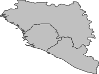
This layer represents the country boundaries for countries that intersect with the Mano River basin. This data was collated to support the “Mano River Ecosystem Conservation and International Water Resources Management (IWRM) Project”, which is implemented by the International Union for Conservation of Nature (IUCN). It targets the conservation and sustainable use of the transboundary water basins and their biodiversity resources within the Mano River Union member states. These resources are of highest importance for the sub-region, seriously affected by socio-political problems with displaced and suffering populations, and demand support under these very difficult contexts. The project seeks to promote holistic approaches to integrated ecosystem management and to design participatory and community–based strategies, which will lead to in-situ conservation and sustainable use of soil, water and biota in the river basins and on their watersheds.
- License
- Not Specified
-
+ The original author did not specify a license.
- Publication Date
- May 31, 2019, 3:35 a.m.
- Type
- Vector Data
- Keywords
- Mano River MRU
- Category
- River Basins
- A river basin is an area of land drained by a river and its tributaries.
- Regions
- Africa, West Africa, Guinea, Liberia, Sierra Leone
- Published
- Yes
- Featured
- No
- Name
- ManoRiverUnion
- Position
- Organization
- Location
- Voice
- Fax
- Identification Image
-
- Spatial Resolution
- ---
- Projetion System
- EPSG:4326
- Extension x0
- -15.0646600000
- Extension x1
- -7.3685599910
- Extension y0
- 4.3540043120
- Extension y1
- 12.6762200000
- Maintenance Frequency
- Frequency Of Maintenance For The Data Is Not Known
- Purpose
Creating maps of the Mano River basin
- Language
- English
- Supplemental Information
No information provided
- Spatial Representation Type
- vector data is used to represent geographic data
- Name
- ManoRiverUnion
- Position
- Organization
- Location
- Voice
- Fax
- Link Online
- /layers/geonode:mru_state_boundaries
- Metadata Page
- /layers/geonode:mru_state_boundaries/metadata_detail
- Tiles
- mru Mano River basin country boundaries.tiles
- Legend
- mru Mano River basin country boundaries.png
- Thumbnail
- mru Mano River basin country boundaries.png
- Remote Thumbnail
- mru Mano River basin country boundaries.png
- View in Google Earth
- mru Mano River basin country boundaries.kml
- KML
- mru Mano River basin country boundaries.kml
- GeoJSON
- mru Mano River basin country boundaries.json
- Excel
- mru Mano River basin country boundaries.excel
- CSV
- mru Mano River basin country boundaries.csv
- GML 3.1.1
- mru Mano River basin country boundaries.gml
- GML 2.0
- mru Mano River basin country boundaries.gml
- Zipped Shapefile
- mru Mano River basin country boundaries.zip
- PNG
- mru Mano River basin country boundaries.png
- mru Mano River basin country boundaries.pdf
- JPEG
- mru Mano River basin country boundaries.jpg
- OGC WFS: geonode Service
- Geoservice OGC:WFS
- OGC WMS: geonode Service
- Geoservice OGC:WMS
- Name
- ManoRiverUnion
- Position
- Organization
- Location
- Voice
- Fax