- Title
- Guyot geomorphic feature layer
- Abstract
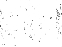
The guyot geomorphic feature layer represents the spatial extent of the guyots of the worlds oceans based on interpretation of the SRTM30 plus v7 global bathymetry model. The layer is one of the 25 layers that make up the global seafloor geomorphic features map (Harris et.al. 2014). Guyots are “an isolated (or group of) seamount (s) having a comparatively smooth flat top. Also called tablemount(s)” (IHO, 2008). In this study the seamount base layer was used to mask the SRTM30_PLUS model. The gradient of the resulting grid was calculated (ArcGIS 10->DEM Surface Tools (Jenness 2012)->Slope, Slope computation method = 4-cell method). The gradient was classified into areas >2 degrees and areas <2 degrees. The areas less than two degrees were converted into vector layers. Where these occurred at the top of seamounts and were greater than a minimum size threshold (10 km2) they were flagged as possible guyots. These possible guyots were then visually checked...
- Publication Date
- Feb. 20, 2014, midnight
- Type
- Vector Data
- Keywords
- oceans seafloor, geomorphic features, habitats
- Category
- Geoscientific Information
- information pertaining to earth sciences. Examples: geophysical features and processes, geology, minerals, sciences dealing with the composition, structure and origin of the earth s rocks, risks of earthquakes, volcanic activity, landslides, gravity information, soils, permafrost, hydrogeology, erosion
- Regions
- Global
- Published
- Yes
- Featured
- No
- Name
- Miles Macmillan-Lawler (miles_GRIDA)
- miles.macmillan-Lawler@grida.no
- Position
- Programme Lead
- Organization
- GRID-Arendal
- Location
- NOR
- Voice
- Fax
- Keywords
- Marine Spatial Analysis Data IWLEARN
- Identification Image
-
- Spatial Resolution
- ---
- Projetion System
- EPSG:4326
- Extension x0
- -179.9472129675
- Extension x1
- 178.5573167058
- Extension y0
- -69.0158504043
- Extension y1
- 57.6414688729
- Restrictions
- The global seafloor geomorphic feature map is available for download from bluehabitats.org
- Purpose
The guyot geomorphic feature layer represents the spatial extent of the guyots of the worlds oceans based on interpretation of the SRTM30 plus v7 global b...
- Language
- English
- Supplemental Information
No information provided
- Spatial Representation Type
- vector data is used to represent geographic data
- Name
- Miles Macmillan-Lawler (miles_GRIDA)
- miles.macmillan-Lawler@grida.no
- Position
- Programme Lead
- Organization
- GRID-Arendal
- Location
- NOR
- Voice
- Fax
- Link Online
- /layers/geonode:guyots
- Metadata Page
- /layers/geonode:guyots/metadata_detail
- Tiles
- Guyot geomorphic feature layer.tiles
- Legend
- Guyot geomorphic feature layer.png
- Thumbnail
- Guyot geomorphic feature layer.png
- Remote Thumbnail
- Guyot geomorphic feature layer.png
- View in Google Earth
- Guyot geomorphic feature layer.kml
- KML
- Guyot geomorphic feature layer.kml
- GeoJSON
- Guyot geomorphic feature layer.json
- Excel
- Guyot geomorphic feature layer.excel
- CSV
- Guyot geomorphic feature layer.csv
- GML 3.1.1
- Guyot geomorphic feature layer.gml
- GML 2.0
- Guyot geomorphic feature layer.gml
- Zipped Shapefile
- Guyot geomorphic feature layer.zip
- PNG
- Guyot geomorphic feature layer.png
- Guyot geomorphic feature layer.pdf
- JPEG
- Guyot geomorphic feature layer.jpg
- OGC WFS: geonode Service
- Geoservice OGC:WFS
- OGC WMS: geonode Service
- Geoservice OGC:WMS
- Name
- Miles Macmillan-Lawler (miles_GRIDA)
- miles.macmillan-Lawler@grida.no
- Position
- Programme Lead
- Organization
- GRID-Arendal
- Location
- NOR
- Voice
- Fax
- Keywords
- Marine Spatial Analysis Data IWLEARN