- Title
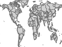
- gnc large river basins
- Abstract
Large river basins
- License
- Not Specified
-
+ The original author did not specify a license.
- Publication Date
- May 2, 2019, 7:09 a.m.
- Type
- Vector Data
- Keywords
- Global Nutrient Cycle GNC large river basins
- Category
- River Basins
- A river basin is an area of land drained by a river and its tributaries.
- Regions
- Global
- Published
- Yes
- Featured
- No
- Name
- Global_Nutrient_Cycle
- Position
- Organization
- Location
- Voice
- Fax
- Identification Image
-
- Spatial Resolution
- ---
- Projetion System
- EPSG:4326
- Extension x0
- -180.0109100851
- Extension x1
- 180.0204744037
- Extension y0
- -55.5067274068
- Extension y1
- 83.5115630737
- Maintenance Frequency
- There Are No Plans To Update The Data
- Language
- English
- Supplemental Information
No information provided
- Name
- Global_Nutrient_Cycle
- Position
- Organization
- Location
- Voice
- Fax
- Link Online
- /layers/geonode:gnc_large_river_basins
- Metadata Page
- /layers/geonode:gnc_large_river_basins/metadata_detail
- Tiles
- gnc large river basins.tiles
- Legend
- gnc large river basins.png
- Thumbnail
- gnc large river basins.png
- Remote Thumbnail
- gnc large river basins.png
- View in Google Earth
- gnc large river basins.kml
- KML
- gnc large river basins.kml
- GeoJSON
- gnc large river basins.json
- Excel
- gnc large river basins.excel
- CSV
- gnc large river basins.csv
- GML 3.1.1
- gnc large river basins.gml
- GML 2.0
- gnc large river basins.gml
- Zipped Shapefile
- gnc large river basins.zip
- PNG
- gnc large river basins.png
- gnc large river basins.pdf
- JPEG
- gnc large river basins.jpg
- OGC WFS: geonode Service
- Geoservice OGC:WFS
- OGC WMS: geonode Service
- Geoservice OGC:WMS
- Name
- Global_Nutrient_Cycle
- Position
- Organization
- Location
- Voice
- Fax