- Title
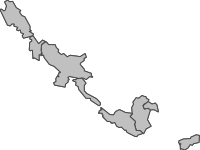
- Diktas Transboundary Aquifers
- Abstract
No abstract provided
- Publication Date
- May 31, 2018, 5:41 a.m.
- Type
- Vector Data
- Keywords
- Aquifer DIKTAS Dinaric Karst System
- Category
- Aquifers
- An aquifer is an underground layer of water-bearing rock. Water-bearing rocks are permeable, meaning that they have openings that liquids and gases can pass through. Sedimentary rock such as sandstone, as well as sand and gravel, are examples of water-bearing rock. The top of the water level in an aquifer is called the water table.
- Regions
- Europe, Albania, Croatia, Montenegro
- Published
- Yes
- Featured
- No
- Name
- diktas
- Position
- Organization
- Location
- Voice
- Fax
- Spatial Resolution
- ---
- Projetion System
- EPSG:4326
- Extension x0
- 15.5091300160
- Extension x1
- 19.7582300430
- Extension y0
- 42.2990871510
- Extension y1
- 44.9479509940
- Language
- English
- Supplemental Information
No information provided
- Name
- diktas
- Position
- Organization
- Location
- Voice
- Fax
- Link Online
- /layers/geonode:diktas_transboundary_aquifers
- Metadata Page
- /layers/geonode:diktas_transboundary_aquifers/metadata_detail
- Tiles
- Diktas Transboundary Aquifers.tiles
- Legend
- Diktas Transboundary Aquifers.png
- Thumbnail
- Diktas Transboundary Aquifers.png
- Remote Thumbnail
- Diktas Transboundary Aquifers.png
- View in Google Earth
- Diktas Transboundary Aquifers.kml
- KML
- Diktas Transboundary Aquifers.kml
- GeoJSON
- Diktas Transboundary Aquifers.json
- Excel
- Diktas Transboundary Aquifers.excel
- CSV
- Diktas Transboundary Aquifers.csv
- GML 3.1.1
- Diktas Transboundary Aquifers.gml
- GML 2.0
- Diktas Transboundary Aquifers.gml
- Zipped Shapefile
- Diktas Transboundary Aquifers.zip
- PNG
- Diktas Transboundary Aquifers.png
- Diktas Transboundary Aquifers.pdf
- JPEG
- Diktas Transboundary Aquifers.jpg
- OGC WFS: geonode Service
- Geoservice OGC:WFS
- OGC WMS: geonode Service
- Geoservice OGC:WMS
- Name
- diktas
- Position
- Organization
- Location
- Voice
- Fax
