- Title
- World Database on Protected Areas (WDPA_poly)
- Abstract
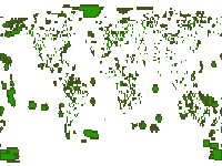
The World Database on Protected Areas (WDPA) is the most comprehensive global database of marine and terrestrial protected areas and is one of the key global biodiversity datasets being widely used by scientists, businesses, governments, International secretariats and others to inform planning, policy decisions and management.
The WDPA is a joint project between UN Environment and the International Union for Conservation of Nature (IUCN). The compilation and management of the WDPA is carried out by UN Environment World Conservation Monitoring Centre (UNEP-WCMC), in collaboration with governments, non-governmental organisations, academia and industry. There are monthly updates of the data which are made available online through the Protected Planet website where the data is both viewable and downloadable.
http://data.unep-wcmc.org/datasets/1
- Publication Date
- Nov. 25, 2017, 8:37 a.m.
- Type
- Data
- Category
- Others
- Any spatial layer which is not fall under the predefined category
- Regions
- Global
- Published
- Yes
- Featured
- No
- Name
- gridanode
- devrsgis@gmail.com
- Position
- Organization
- GRID-Arendal
- Location
- Voice
- Fax
- Spatial Resolution
- ---
- Projetion System
- EPSG:4326
- Extension x0
- -180.0000000000
- Extension x1
- 180.0000000000
- Extension y0
- -90.0000000000
- Extension y1
- 90.0000000000
- Language
- English
- Supplemental Information
No information provided
- Name
- gridanode
- devrsgis@gmail.com
- Position
- Organization
- GRID-Arendal
- Location
- Voice
- Fax
- Link Online
- /layers/geonode:WDPA_Polygon
- Metadata Page
- /layers/geonode:WDPA_Polygon/metadata_detail
- Tiles
- World Database on Protected Areas (WDPA_poly).tiles
- Legend
- World Database on Protected Areas (WDPA_poly).png
- Thumbnail
- World Database on Protected Areas (WDPA_poly).png
- Remote Thumbnail
- World Database on Protected Areas (WDPA_poly).png
- View in Google Earth
- World Database on Protected Areas (WDPA_poly).kml
- KML
- World Database on Protected Areas (WDPA_poly).kml
- PNG
- World Database on Protected Areas (WDPA_poly).png
- World Database on Protected Areas (WDPA_poly).pdf
- JPEG
- World Database on Protected Areas (WDPA_poly).jpg
- OGC WMS: geonode Service
- Geoservice OGC:WMS
- Name
- gridanode
- devrsgis@gmail.com
- Position
- Organization
- GRID-Arendal
- Location
- Voice
- Fax
