- Title
- Seagrass Points 2005 (WCMC-013)
- Abstract
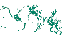
This dataset shows the global distribution of seagrasses, and is composed of two subsets of point and polygon occurence data. The data were compiled by UNEP World Conservation Monitoring Centre in collaboration with many collaborators (e.g. Frederick Short of the University of New Hampshire), organisations (e.g. OSPAR), and projects (e.g. the European project Mediterranean Sensitive Habitats "Mediseh"), across the globe (full list available in "Seagrass_Metadata_v4.dbf").
http://data.unep-wcmc.org/datasets/7
- Publication Date
- Nov. 25, 2017, 7:22 a.m.
- Type
- Data
- Category
- Oceans
- Ocean is defined as the body of salt water covering much of the Earth or a large quantity of something.
- Regions
- Global
- Published
- Yes
- Featured
- No
- Name
- gridanode
- devrsgis@gmail.com
- Position
- Organization
- GRID-Arendal
- Location
- Voice
- Fax
- Identification Image
-
- Spatial Resolution
- ---
- Projetion System
- EPSG:4326
- Extension x0
- -180.0000000000
- Extension x1
- 180.0000000000
- Extension y0
- -90.0000000000
- Extension y1
- 90.0000000000
- Language
- English
- Supplemental Information
No information provided
- Name
- gridanode
- devrsgis@gmail.com
- Position
- Organization
- GRID-Arendal
- Location
- Voice
- Fax
- Link Online
- /layers/geonode:Seagrass
- Metadata Page
- /layers/geonode:Seagrass/metadata_detail
- Tiles
- Seagrass Points 2005 (WCMC-013).tiles
- Legend
- Seagrass Points 2005 (WCMC-013).png
- Thumbnail
- Seagrass Points 2005 (WCMC-013).png
- Remote Thumbnail
- Seagrass Points 2005 (WCMC-013).png
- View in Google Earth
- Seagrass Points 2005 (WCMC-013).kml
- KML
- Seagrass Points 2005 (WCMC-013).kml
- PNG
- Seagrass Points 2005 (WCMC-013).png
- Seagrass Points 2005 (WCMC-013).pdf
- JPEG
- Seagrass Points 2005 (WCMC-013).jpg
- OGC WMS: geonode Service
- Geoservice OGC:WMS
- Name
- gridanode
- devrsgis@gmail.com
- Position
- Organization
- GRID-Arendal
- Location
- Voice
- Fax