- Title
- TM_Sea level rise from 1994 to 2015 (NOAA Laboratory for Satellite Altimetry )
- Abstract
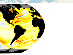
Image of the sea level rise from 1994 to 2015 from the NOAA Laboratory for Satellite Altimetry
- Publication Date
- May 5, 2019, 2:21 p.m.
- Type
- Data
- Keywords
- Level Rise Sea
- Published
- Yes
- Featured
- No
- Name
- gridanode
- devrsgis@gmail.com
- Position
- Organization
- GRID-Arendal
- Location
- Voice
- Fax
- Identification Image
-
- Spatial Resolution
- ---
- Projetion System
- EPSG:900913
- Extension x0
- -353.6136793336
- Extension x1
- 45.6601650026
- Extension y0
- -105.6437059671
- Extension y1
- 66.5431394029
- Language
- English
- Supplemental Information
No information provided
- Name
- gridanode
- devrsgis@gmail.com
- Position
- Organization
- GRID-Arendal
- Location
- Voice
- Fax
- Link Online
- /layers/Caribbean_Marine_Atlas:geonode:mssh_2014_1993_3001
- Metadata Page
- /layers/Caribbean_Marine_Atlas:geonode:mssh_2014_1993_3001/metadata_detail
- Thumbnail
- TM_Sea level rise from 1994 to 2015 (NOAA Laboratory for Satellite Altimetry ).png
- Name
- gridanode
- devrsgis@gmail.com
- Position
- Organization
- GRID-Arendal
- Location
- Voice
- Fax