- Title
- TM_BELIZE_Mangrove_100.000_2010
- Abstract
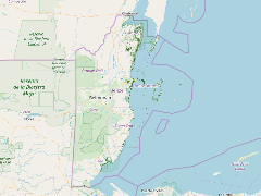
This dataset depicts fragmentation and resiliency of Belize's national mangrove cover in 2010, based on satellite-based mapping of Belize's mangroves for 1980, 1989, 1994, 2000, 2004, and 2010, and based on the earlier work of Simon Zisman (1998). Fragmentation was analyzed by identifying mangrove patches which had been reduced in size within the period analyzed. Based on that, a fragmentation history was compiled, and risk was estimated based off that history. In addition to the fragmentation history, an index of patch irregularity (related to the perimeter and area) was also developed. Resiliency was also identified based on identification of mangroves which had regrown after clearance. This data was developed for the World Wildlife Fund (WWF)'s Mesoamerican Reef program in July 2010.
- Publication Date
- May 5, 2019, 2:21 p.m.
- Type
- Data
- Keywords
- mangrove
- Published
- Yes
- Featured
- No
- Name
- gridanode
- devrsgis@gmail.com
- Position
- Organization
- GRID-Arendal
- Location
- Voice
- Fax
- Identification Image
-
- Spatial Resolution
- ---
- Projetion System
- EPSG:900913
- Extension x0
- -89.0888239473
- Extension x1
- -87.4910749271
- Extension y0
- 15.9016486027
- Extension y1
- 18.4893742429
- Language
- English
- Supplemental Information
No information provided
- Name
- gridanode
- devrsgis@gmail.com
- Position
- Organization
- GRID-Arendal
- Location
- Voice
- Fax
- Link Online
- /layers/Caribbean_Marine_Atlas:geonode:mangrovev2
- Metadata Page
- /layers/Caribbean_Marine_Atlas:geonode:mangrovev2/metadata_detail
- Thumbnail
- TM_BELIZE_Mangrove_100.000_2010.png
- Name
- gridanode
- devrsgis@gmail.com
- Position
- Organization
- GRID-Arendal
- Location
- Voice
- Fax