- Title
- TM-BRB_Bathymetry-1999-2m Resolution
- Abstract
This dataset displays Contours derived from a bathymetric surface gridded from a LIDAR survey of Barbados performed in 1999. Aerial LIDAR has a maximum water penetration of about 40m and as such the LIDAR information (and resulting contours) do not extend far beyond this depth. LIDAR information was originally collected in the Barbados National Grid coordinate system and subsequently converted to WGS84 via a coordinate frame transformation.
- Publication Date
- May 5, 2019, 2:20 p.m.
- Type
- Data
- Keywords
- Barbados Bathymetry
- Published
- Yes
- Featured
- No
- Name
- gridanode
- devrsgis@gmail.com
- Position
- Organization
- GRID-Arendal
- Location
- Voice
- Fax
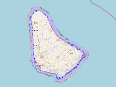
- Identification Image
-
- Spatial Resolution
- ---
- Projetion System
- EPSG:900913
- Extension x0
- -59.6662700245
- Extension x1
- -59.3954444089
- Extension y0
- 13.0247425713
- Extension y1
- 13.3505753539
- Language
- English
- Supplemental Information
No information provided
- Name
- gridanode
- devrsgis@gmail.com
- Position
- Organization
- GRID-Arendal
- Location
- Voice
- Fax
- Link Online
- /layers/Caribbean_Marine_Atlas:geonode:lidarcontours_wgs_1984_newwww
- Metadata Page
- /layers/Caribbean_Marine_Atlas:geonode:lidarcontours_wgs_1984_newwww/metadata_detail
- Thumbnail
- TM-BRB_Bathymetry-1999-2m Resolution.png
- Name
- gridanode
- devrsgis@gmail.com
- Position
- Organization
- GRID-Arendal
- Location
- Voice
- Fax