- Title
- TV_TTO_Trinidad_and_Tobago_erosion_and_accretion_of_coastal_vegetation_line_1...
- Abstract
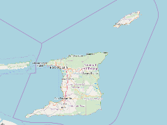
Utilizing remotely sensed imagery and GNSS surveying
techniques through a multi-epoch approach (from 1994 to 2007) to shoreline change analysis, the degree to which
the horizontal shoreline position expanded or retreat was accurately assessed for Trinidad and
Tobago and areas of erosion and accretion identified.
- Publication Date
- May 5, 2019, 2:20 p.m.
- Type
- Data
- Keywords
- accretion coastline change erosion
- Published
- Yes
- Featured
- No
- Name
- gridanode
- devrsgis@gmail.com
- Position
- Organization
- GRID-Arendal
- Location
- Voice
- Fax
- Identification Image
-
- Spatial Resolution
- ---
- Projetion System
- EPSG:900913
- Extension x0
- -61.9304017365
- Extension x1
- -60.4944153350
- Extension y0
- 10.0355698508
- Extension y1
- 11.3511479221
- Language
- English
- Supplemental Information
No information provided
- Name
- gridanode
- devrsgis@gmail.com
- Position
- Organization
- GRID-Arendal
- Location
- Voice
- Fax
- Link Online
- /layers/Caribbean_Marine_Atlas:geonode:garb1_2
- Metadata Page
- /layers/Caribbean_Marine_Atlas:geonode:garb1_2/metadata_detail
- Thumbnail
- TV_TTO_Trinidad_and_Tobago_erosion_and_accretion_of_coastal_vegetation_line_1994_to_2007.png
- Name
- gridanode
- devrsgis@gmail.com
- Position
- Organization
- GRID-Arendal
- Location
- Voice
- Fax