- Title
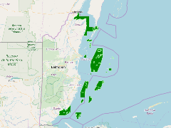
- TM_BELIZE_Coastal protected areas_100.000_2014
- Abstract
Digital protected area polygon data was created using the legal descritpions of the boundaries as published on the Government Gazette Statutory Instruments (legal decrees).
Coastal Reserves 2014: Produced in 2014 by Land Information Centre/CZMAI with a preferential scale of 1:100,000. With a national coverage in polygon format
- Publication Date
- May 5, 2019, 2:18 p.m.
- Type
- Data
- Keywords
- areas Protected
- Published
- Yes
- Featured
- No
- Name
- gridanode
- devrsgis@gmail.com
- Position
- Organization
- GRID-Arendal
- Location
- Voice
- Fax
- Identification Image
-
- Spatial Resolution
- ---
- Projetion System
- EPSG:900913
- Extension x0
- -88.7975725251
- Extension x1
- -87.4351139523
- Extension y0
- 16.0464293651
- Extension y1
- 18.4925424825
- Language
- English
- Supplemental Information
No information provided
- Name
- gridanode
- devrsgis@gmail.com
- Position
- Organization
- GRID-Arendal
- Location
- Voice
- Fax
- Link Online
- /layers/Caribbean_Marine_Atlas:geonode:coastal_reserves_2014
- Metadata Page
- /layers/Caribbean_Marine_Atlas:geonode:coastal_reserves_2014/metadata_detail
- Thumbnail
- TM_BELIZE_Coastal protected areas_100.000_2014.png
- Name
- gridanode
- devrsgis@gmail.com
- Position
- Organization
- GRID-Arendal
- Location
- Voice
- Fax