- Title
- OSPAR Regions (North-East Atlantic, 2014)
- Abstract
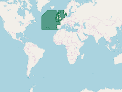
Shapefile created based on the outer en inner boundary of the OSPAR maritime area. Both shapefiles were downloaded from the OSPAR website and merged into 1 file (2014-04-25).
The coastline used is EEA coastline for analysis (line) - version 1.0, Jun. 2013 from the European Environment Agency.
- Publication Date
- July 2, 2019, 6:38 p.m.
- Type
- Data
- Keywords
- features OSPAR Convention ospar_regions
- Published
- Yes
- Featured
- No
- Name
- gridanode
- devrsgis@gmail.com
- Position
- Organization
- GRID-Arendal
- Location
- Voice
- Fax
- Identification Image
-
- Spatial Resolution
- ---
- Projetion System
- EPSG:900913
- Extension x0
- -44.1991769995
- Extension x1
- 51.0000830649
- Extension y0
- 36.0000000000
- Extension y1
- 89.9999942353
- Language
- English
- Supplemental Information
No information provided
- Name
- gridanode
- devrsgis@gmail.com
- Position
- Organization
- GRID-Arendal
- Location
- Voice
- Fax
- Link Online
- /layers/Marine_Regions_web_services:ospar_regions
- Metadata Page
- /layers/Marine_Regions_web_services:ospar_regions/metadata_detail
- Thumbnail
- OSPAR Regions (North-East Atlantic, 2014).png
- Name
- gridanode
- devrsgis@gmail.com
- Position
- Organization
- GRID-Arendal
- Location
- Voice
- Fax