- Title
- TV_TTO_Tobago_coastline_type
- Abstract
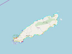
The coastline type (mangrove, coarse grained sandy beaches, exposed rocky platform, exposed vertiacal rocky shore, fine grain sandy beach, gravel beach, rip rap, sheltered rocky shore and tidal flat) was mapped for Tobago
- Publication Date
- May 5, 2019, 2:25 p.m.
- Type
- Data
- Keywords
- coastline type mangrove rip rap rocky platforms rocky shores sandy beaches sea walls tidal flats
- Published
- Yes
- Featured
- No
- Name
- gridanode
- devrsgis@gmail.com
- Position
- Organization
- GRID-Arendal
- Location
- Voice
- Fax
- Identification Image
-
- Spatial Resolution
- ---
- Projetion System
- EPSG:900913
- Extension x0
- -60.8458798113
- Extension x1
- -60.5175477674
- Extension y0
- 11.1343981617
- Extension y1
- 11.3464868286
- Language
- English
- Supplemental Information
No information provided
- Name
- gridanode
- devrsgis@gmail.com
- Position
- Organization
- GRID-Arendal
- Location
- Voice
- Fax
- Link Online
- /layers/Caribbean_Marine_Atlas:geonode:tv_tobago_coastline_type
- Metadata Page
- /layers/Caribbean_Marine_Atlas:geonode:tv_tobago_coastline_type/metadata_detail
- Thumbnail
- TV_TTO_Tobago_coastline_type.png
- Name
- gridanode
- devrsgis@gmail.com
- Position
- Organization
- GRID-Arendal
- Location
- Voice
- Fax