- Title
- TM_usstations_linearsealeveltrends
- Abstract
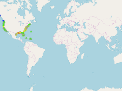
U.S. Linear Relative Mean Sea Level (MSL) trends and 95% Confidence Intervals (CI) in mm/year and in ft/century
- Publication Date
- May 5, 2019, 2:24 p.m.
- Type
- Data
- Keywords
- Indicators Sea Level Rise
- Published
- Yes
- Featured
- No
- Name
- gridanode
- devrsgis@gmail.com
- Position
- Organization
- GRID-Arendal
- Location
- Voice
- Fax
- Identification Image
-
- Spatial Resolution
- ---
- Projetion System
- EPSG:900913
- Extension x0
- -177.3600000000
- Extension x1
- 167.7361000000
- Extension y0
- -14.2767000000
- Extension y1
- 70.4114000000
- Language
- English
- Supplemental Information
No information provided
- Name
- gridanode
- devrsgis@gmail.com
- Position
- Organization
- GRID-Arendal
- Location
- Voice
- Fax
- Link Online
- /layers/Caribbean_Marine_Atlas:geonode:tm_usstations_linearsealeveltrends
- Metadata Page
- /layers/Caribbean_Marine_Atlas:geonode:tm_usstations_linearsealeveltrends/metadata_detail
- Thumbnail
- TM_usstations_linearsealeveltrends.png
- Name
- gridanode
- devrsgis@gmail.com
- Position
- Organization
- GRID-Arendal
- Location
- Voice
- Fax