- Title
- TV_TTO_coral_reefs_2005_25000
- Abstract
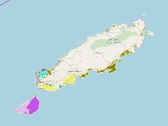
The coral reefs of Tobago were mapped using Landsat satellite imagery
- Publication Date
- May 5, 2019, 2:24 p.m.
- Type
- Data
- Keywords
- Coral Reefs
- Published
- Yes
- Featured
- No
- Name
- gridanode
- devrsgis@gmail.com
- Position
- Organization
- GRID-Arendal
- Location
- Voice
- Fax
- Identification Image
-
- Spatial Resolution
- ---
- Projetion System
- EPSG:900913
- Extension x0
- -60.9208953211
- Extension x1
- -60.4926829881
- Extension y0
- 11.0541177297
- Extension y1
- 11.3561015734
- Language
- English
- Supplemental Information
No information provided
- Name
- gridanode
- devrsgis@gmail.com
- Position
- Organization
- GRID-Arendal
- Location
- Voice
- Fax
- Link Online
- /layers/Caribbean_Marine_Atlas:geonode:tm_tobago_coral_reefs_2005_25000
- Metadata Page
- /layers/Caribbean_Marine_Atlas:geonode:tm_tobago_coral_reefs_2005_25000/metadata_detail
- Thumbnail
- TV_TTO_coral_reefs_2005_25000.png
- Name
- gridanode
- devrsgis@gmail.com
- Position
- Organization
- GRID-Arendal
- Location
- Voice
- Fax