- Title
- TM-BRB_Seagrass Beds - 1997 - 1:5000
- Abstract
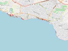
This dataset shows the seagrass beds around the south and west coast of the island .This data was provided by the Coastal Zone Management Unit of Barbados ca.1997.
- Publication Date
- May 5, 2019, 2:22 p.m.
- Type
- Data
- Keywords
- Seagrasses
- Published
- Yes
- Featured
- No
- Name
- gridanode
- devrsgis@gmail.com
- Position
- Organization
- GRID-Arendal
- Location
- Voice
- Fax
- Identification Image
-
- Spatial Resolution
- ---
- Projetion System
- EPSG:900913
- Extension x0
- -59.5819036591
- Extension x1
- -59.5302793548
- Extension y0
- 13.0458966153
- Extension y1
- 13.0702803204
- Language
- English
- Supplemental Information
No information provided
- Name
- gridanode
- devrsgis@gmail.com
- Position
- Organization
- GRID-Arendal
- Location
- Voice
- Fax
- Link Online
- /layers/Caribbean_Marine_Atlas:geonode:seagrass_2
- Metadata Page
- /layers/Caribbean_Marine_Atlas:geonode:seagrass_2/metadata_detail
- Thumbnail
- TM-BRB_Seagrass Beds - 1997 - 1:5000.png
- Name
- gridanode
- devrsgis@gmail.com
- Position
- Organization
- GRID-Arendal
- Location
- Voice
- Fax