- Title
- TM-BRB_Coral Reef Coverage-1998-1:5000
- Abstract
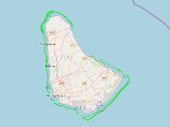
This dataset shows reef locations and reef classification types along the west and south coasts of Barbados as a polygon shapefile. This data was provided by the Coastal Zone Management Unit of Barbados ca.1998
- Publication Date
- May 5, 2019, 2:22 p.m.
- Type
- Data
- Keywords
- REQUIRED: Common-use word or phrase used to describe the subject of the data set.
- Published
- Yes
- Featured
- No
- Name
- gridanode
- devrsgis@gmail.com
- Position
- Organization
- GRID-Arendal
- Location
- Voice
- Fax
- Spatial Resolution
- ---
- Projetion System
- EPSG:900913
- Extension x0
- -59.6666327930
- Extension x1
- -59.3943112051
- Extension y0
- 13.0223018073
- Extension y1
- 13.3512552975
- Language
- English
- Supplemental Information
No information provided
- Name
- gridanode
- devrsgis@gmail.com
- Position
- Organization
- GRID-Arendal
- Location
- Voice
- Fax
- Link Online
- /layers/Caribbean_Marine_Atlas:geonode:reefs_final_wgs_84
- Metadata Page
- /layers/Caribbean_Marine_Atlas:geonode:reefs_final_wgs_84/metadata_detail
- Thumbnail
- TM-BRB_Coral Reef Coverage-1998-1:5000.png
- Name
- gridanode
- devrsgis@gmail.com
- Position
- Organization
- GRID-Arendal
- Location
- Voice
- Fax
