- Title
- TM-BRB_Major Coastal Locations-1997-1:10000
- Abstract
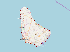
This dataset highlights major coastal infrastructure and locations around the island of Barbados. This dataset was provided by the Coastal Zone Management Unit of Barbados ca.1997.
- Publication Date
- May 5, 2019, 2:21 p.m.
- Type
- Data
- Keywords
- features major_coastal_locations
- Published
- Yes
- Featured
- No
- Name
- gridanode
- devrsgis@gmail.com
- Position
- Organization
- GRID-Arendal
- Location
- Voice
- Fax
- Identification Image
-
- Spatial Resolution
- ---
- Projetion System
- EPSG:900913
- Extension x0
- -59.6478901376
- Extension x1
- -59.4298730748
- Extension y0
- 13.0473537184
- Extension y1
- 13.3346655239
- Language
- English
- Supplemental Information
No information provided
- Name
- gridanode
- devrsgis@gmail.com
- Position
- Organization
- GRID-Arendal
- Location
- Voice
- Fax
- Link Online
- /layers/Caribbean_Marine_Atlas:geonode:major_coastal_locations
- Metadata Page
- /layers/Caribbean_Marine_Atlas:geonode:major_coastal_locations/metadata_detail
- Thumbnail
- TM-BRB_Major Coastal Locations-1997-1:10000.png
- Name
- gridanode
- devrsgis@gmail.com
- Position
- Organization
- GRID-Arendal
- Location
- Voice
- Fax