- Title
- CLME: TV_WCR_IOCaribe area_15_2_2018_no scale
- Abstract
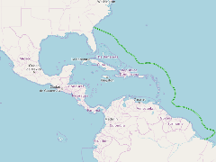
This layer shows the competence area of the IOC Sub-Commission for the Caribbean and Adjacent Regions (IOCaribe). The area extends from Cape Hatteras (North Carolina, United States) in the north to the mouth of the Amazon river (Pará State, Brazil) in the south.
- Publication Date
- May 5, 2019, 2:20 p.m.
- Type
- Data
- Keywords
- CLME+ governance architecture Regional Governance Framework
- Published
- Yes
- Featured
- No
- Name
- gridanode
- devrsgis@gmail.com
- Position
- Organization
- GRID-Arendal
- Location
- Voice
- Fax
- Identification Image
-
- Spatial Resolution
- ---
- Projetion System
- EPSG:900913
- Extension x0
- -109.2368060000
- Extension x1
- -43.9065489325
- Extension y0
- -0.7223619819
- Extension y1
- 31.8040671281
- Language
- English
- Supplemental Information
No information provided
- Name
- gridanode
- devrsgis@gmail.com
- Position
- Organization
- GRID-Arendal
- Location
- Voice
- Fax
- Link Online
- /layers/Caribbean_Marine_Atlas:geonode:iocaribe_area_contour
- Metadata Page
- /layers/Caribbean_Marine_Atlas:geonode:iocaribe_area_contour/metadata_detail
- Thumbnail
- CLME: TV_WCR_IOCaribe area_15_2_2018_no scale.png
- Name
- gridanode
- devrsgis@gmail.com
- Position
- Organization
- GRID-Arendal
- Location
- Voice
- Fax