- Title
- TM-COLOMBIA-Geomorfología de fondos profundos-2013-100.000
- Abstract
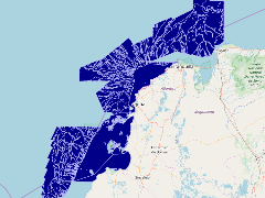
Este shape es el resultado de una integracion de varios procesos de analisis espacial, a partir de interpretacion de datos batimetricos y modelamiento de terreno,con un proceso de sintesis de clasificacion de unidades
CONVENIO INTERADMINISTRATIVO No 57 DE 2013 ENTRE EL MADS Y EL INVEMAR: ELEMENTOS TÉCNICOS Y GENERACIÓN DE CAPACIDAD PARA EL ORDENAMIENTO, CONSERVACIÓN Y MANEJO DE LOS ESPACIOS Y RECURSOS MARINOS, COSTEROS E INSULARES DE COLOMBIA.
Código: ACT-VAR-001-013
- Publication Date
- May 5, 2019, 2:20 p.m.
- Type
- Data
- Keywords
- Fondos Geomorfología
- Published
- Yes
- Featured
- No
- Name
- gridanode
- devrsgis@gmail.com
- Position
- Organization
- GRID-Arendal
- Location
- Voice
- Fax
- Identification Image
-
- Spatial Resolution
- ---
- Projetion System
- EPSG:900913
- Extension x0
- -76.9865951538
- Extension x1
- -74.1038513184
- Extension y0
- 8.8593845365
- Extension y1
- 12.0332098003
- Language
- English
- Supplemental Information
No information provided
- Name
- gridanode
- devrsgis@gmail.com
- Position
- Organization
- GRID-Arendal
- Location
- Voice
- Fax
- Link Online
- /layers/Caribbean_Marine_Atlas:geonode:geomofondosprofundos
- Metadata Page
- /layers/Caribbean_Marine_Atlas:geonode:geomofondosprofundos/metadata_detail
- Thumbnail
- TM-COLOMBIA-Geomorfología de fondos profundos-2013-100.000.png
- Name
- gridanode
- devrsgis@gmail.com
- Position
- Organization
- GRID-Arendal
- Location
- Voice
- Fax