- Title
- TM-VENEZUELA-Impacto centros poblados
- Abstract
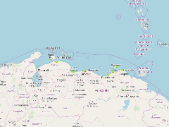
El conjunto de datos contenidos en este archivo corresponde al grado de amenaza de los centros poblados cercanos a la costa, a los diferentes objetos de conservación, en el área correspondiente al Mar Caribe venezolano hasta una latitud de trece grados norte.
- Publication Date
- May 5, 2019, 2:18 p.m.
- Type
- Data
- Keywords
- Amenazas
- Published
- Yes
- Featured
- No
- Name
- gridanode
- devrsgis@gmail.com
- Position
- Organization
- GRID-Arendal
- Location
- Voice
- Fax
- Identification Image
-
- Spatial Resolution
- ---
- Projetion System
- EPSG:900913
- Extension x0
- -71.9928004994
- Extension x1
- -61.9226006146
- Extension y0
- 10.0243339904
- Extension y1
- 12.1751130495
- Language
- English
- Supplemental Information
No information provided
- Name
- gridanode
- devrsgis@gmail.com
- Position
- Organization
- GRID-Arendal
- Location
- Voice
- Fax
- Link Online
- /layers/Caribbean_Marine_Atlas:geonode:centros_poblados
- Metadata Page
- /layers/Caribbean_Marine_Atlas:geonode:centros_poblados/metadata_detail
- Thumbnail
- TM-VENEZUELA-Impacto centros poblados.png
- Name
- gridanode
- devrsgis@gmail.com
- Position
- Organization
- GRID-Arendal
- Location
- Voice
- Fax