- Title
- TM-BRB_Benthic Habitat (South and East Coast)-1998-1:5000
- Abstract
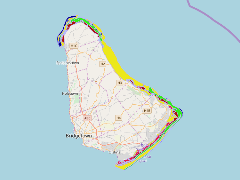
Surveys of the marine habitats along the South-East,East and North-West coasts of Barbados from inter tidal zone to the 50 metre depth contour. Using walkover , scuba diving and snorkel survey techniques.The extents were from Maycocks Bay, between Harrison Point and Arawak Cement plant to South Point . This data was provided by in August 1998.
- Publication Date
- May 5, 2019, 2:17 p.m.
- Type
- Data
- Keywords
- benthic_habitat_wgs84_2 features
- Published
- Yes
- Featured
- No
- Name
- gridanode
- devrsgis@gmail.com
- Position
- Organization
- GRID-Arendal
- Location
- Voice
- Fax
- Identification Image
-
- Spatial Resolution
- ---
- Projetion System
- EPSG:900913
- Extension x0
- -59.6657459983
- Extension x1
- -59.3951129381
- Extension y0
- 13.0250773426
- Extension y1
- 13.3502552479
- Language
- English
- Supplemental Information
No information provided
- Name
- gridanode
- devrsgis@gmail.com
- Position
- Organization
- GRID-Arendal
- Location
- Voice
- Fax
- Link Online
- /layers/Caribbean_Marine_Atlas:geonode:benthic_habitat_wgs84_2
- Metadata Page
- /layers/Caribbean_Marine_Atlas:geonode:benthic_habitat_wgs84_2/metadata_detail
- Thumbnail
- TM-BRB_Benthic Habitat (South and East Coast)-1998-1:5000.png
- Name
- gridanode
- devrsgis@gmail.com
- Position
- Organization
- GRID-Arendal
- Location
- Voice
- Fax