- Title
- TV_JAM_JAMAICA-Class B Roads
- Abstract
No abstract providedThe Data was created under the Jamaican Coastal Project in 1997. The output of the project, A Coastal Atlas of Jamaica, was prepared by the Natural Resources Conservation Authority (NRCA) and Uppsala University, Sweden.
- Publication Date
- May 5, 2019, 2:17 p.m.
- Type
- Data
- Keywords
- b_roads features
- Published
- Yes
- Featured
- No
- Name
- gridanode
- devrsgis@gmail.com
- Position
- Organization
- GRID-Arendal
- Location
- Voice
- Fax
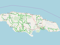
- Identification Image
-
- Spatial Resolution
- ---
- Projetion System
- EPSG:900913
- Extension x0
- -78.2072767522
- Extension x1
- -76.2689116873
- Extension y0
- 17.8028015084
- Extension y1
- 18.4892594078
- Language
- English
- Supplemental Information
No information provided
- Name
- gridanode
- devrsgis@gmail.com
- Position
- Organization
- GRID-Arendal
- Location
- Voice
- Fax
- Link Online
- /layers/Caribbean_Marine_Atlas:geonode:b_roads
- Metadata Page
- /layers/Caribbean_Marine_Atlas:geonode:b_roads/metadata_detail
- Thumbnail
- TV_JAM_JAMAICA-Class B Roads.png
- Name
- gridanode
- devrsgis@gmail.com
- Position
- Organization
- GRID-Arendal
- Location
- Voice
- Fax