- Title
- Marine and land zones: the union of world country boundaries and EEZ's
- Abstract
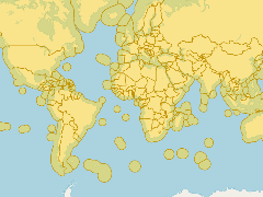
This dataset combines the boundaries of the world countries and the Exclusive Economic Zones of the world. It was created by combining the ESRI world country database and the EEZ version 8 dataset.
- Publication Date
- July 2, 2019, 6:38 p.m.
- Type
- Data
- Keywords
- eez_land features
- Published
- Yes
- Featured
- No
- Name
- gridanode
- devrsgis@gmail.com
- Position
- Organization
- GRID-Arendal
- Location
- Voice
- Fax
- Identification Image
-
- Spatial Resolution
- ---
- Projetion System
- EPSG:900913
- Extension x0
- -181.8000183105
- Extension x1
- 181.8000183105
- Extension y0
- -90.8851165771
- Extension y1
- 87.9090652466
- Language
- English
- Supplemental Information
No information provided
- Name
- gridanode
- devrsgis@gmail.com
- Position
- Organization
- GRID-Arendal
- Location
- Voice
- Fax
- Link Online
- /layers/Marine_Regions_web_services:eez_land
- Metadata Page
- /layers/Marine_Regions_web_services:eez_land/metadata_detail
- Thumbnail
- Marine and land zones: the union of world country boundaries and EEZ's.png
- Name
- gridanode
- devrsgis@gmail.com
- Position
- Organization
- GRID-Arendal
- Location
- Voice
- Fax