- Thumbnail
- Resource ID
- e979c12a-815d-11e9-8d7d-000d3ab6a624
- Title
- MRU_main_settlements
- Date
- May 28, 2019, 10:33 a.m., Publication
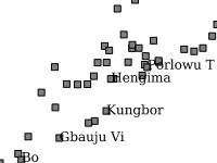
- Abstract
- Location of main settlements in the Mano River Basin. Data provided by the Mano River Union ecosystem conservation and international water resource management project.
- Edition
- --
- Owner
- MRU_IWRM
- Point of Contact
- Purpose
- the layer is to be used on basin scale maps
- Maintenance Frequency
- unknown
- Type
- vector
- Restrictions
- None
- License
- None
- Language
- eng
- Temporal Extent
- Start
- --
- End
- --
- Supplemental Information
- No information provided
- Data Quality
- the quality of this data is unknown
- Extent
-
- long min: -11.5753096000
- long max: -9.5379827000
- lat min: 6.9694227000
- lat max: 9.0882184000
- Spatial Reference System Identifier
- EPSG:4326
- Keywords
- no keywords
- Category
- River Basins
- Regions
-
West Africa
,
Guinea
,
Liberia
,
Sierra Leone