- Thumbnail
- Resource ID
- 6353374d-6f6b-11e9-8d7d-000d3ab6a624
- Title
- TM_usstations_linearsealeveltrends
- Date
- May 5, 2019, 2:24 p.m., Publication
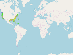
- Abstract
- U.S. Linear Relative Mean Sea Level (MSL) trends and 95% Confidence Intervals (CI) in mm/year and in ft/century
- Edition
- --
- Owner
- gridanode
- Point of Contact
- devrsgis@gmail.com
- Purpose
- --
- Maintenance Frequency
- None
- Type
- not filled
- Restrictions
- None
- None
- License
- None
- Language
- eng
- Temporal Extent
- Start
- --
- End
- --
- Supplemental Information
- No information provided
- Data Quality
- --
- Extent
-
- long min: -177.3600000000
- long max: 167.7361000000
- lat min: -14.2767000000
- lat max: 70.4114000000
- Spatial Reference System Identifier
- EPSG:900913
- Keywords
- no keywords
- Category
- None